Create flights
Set the release point and loft, then view a clear flight route on the map.
Check conditions along the whole route, compare weather layers and plan up to 5 days ahead. Everything is presented in one workspace made for pigeon breeders.
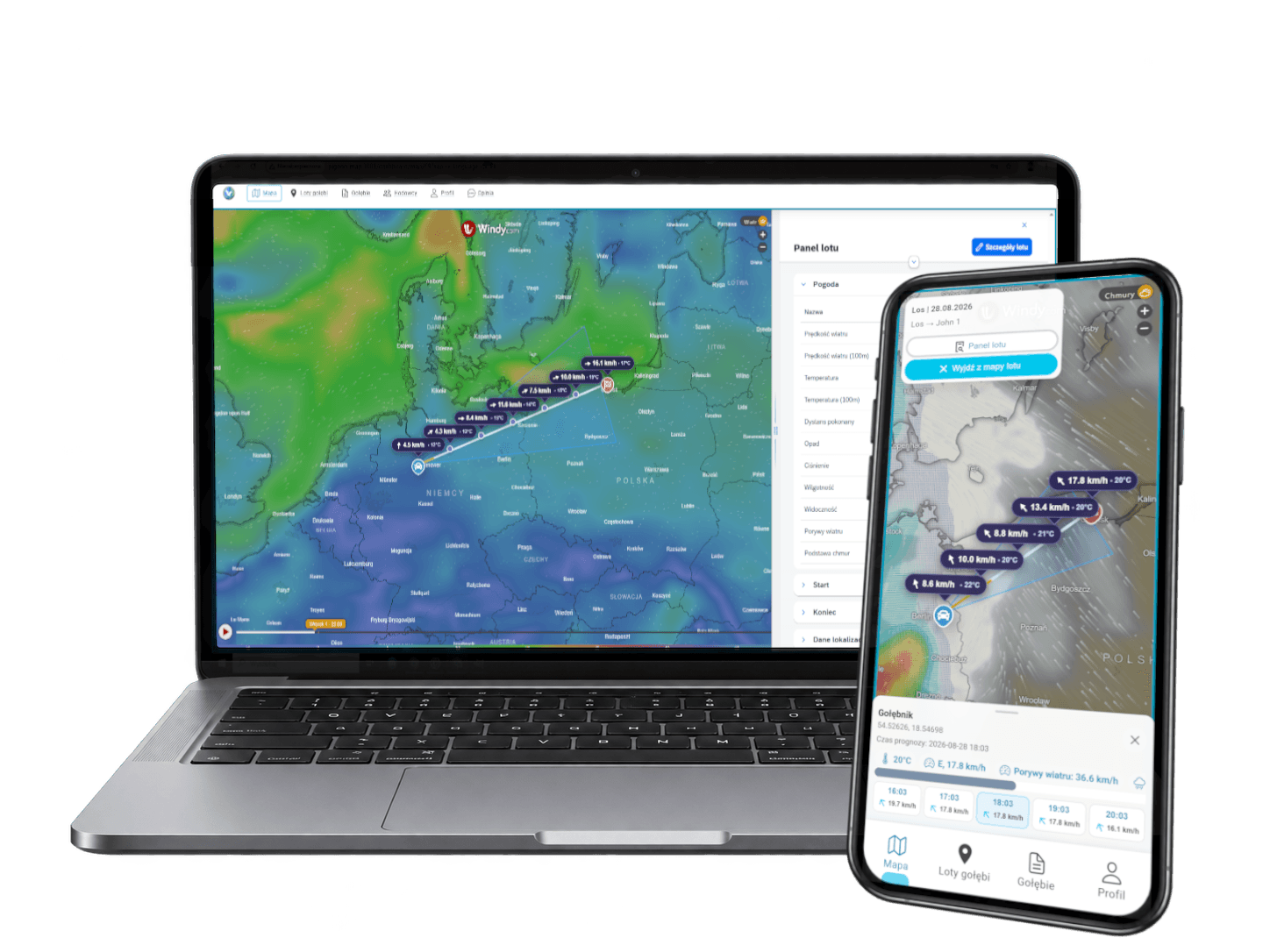
Create flights and analyse forecasts anywhere on the map. Pigeon Map connects the route with weather data so you can assess conditions from the release point to the loft.
Set the release point and loft, then view a clear flight route on the map.
Check conditions at the start, finish and intermediate points along the route.
Switch layers to analyse wind, clouds, precipitation and more.
Compare upcoming days and hours before choosing the flight date.
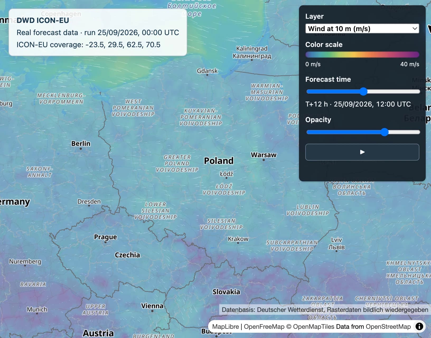
Weather layers appear directly beneath the route. Labels at successive points help you compare wind speed and temperature without switching between apps.
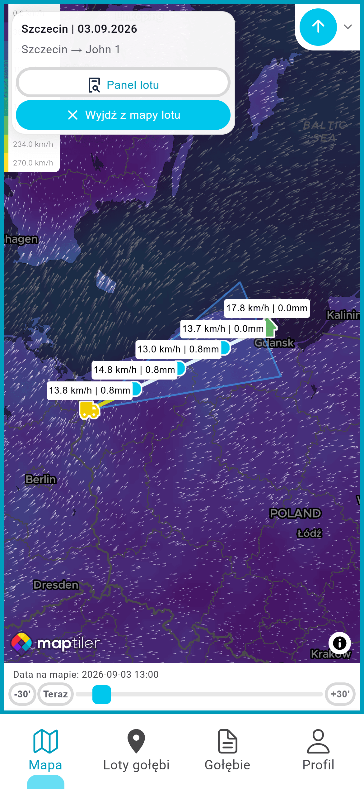
A basic map view with the route, flight points, wind and precipitation data.
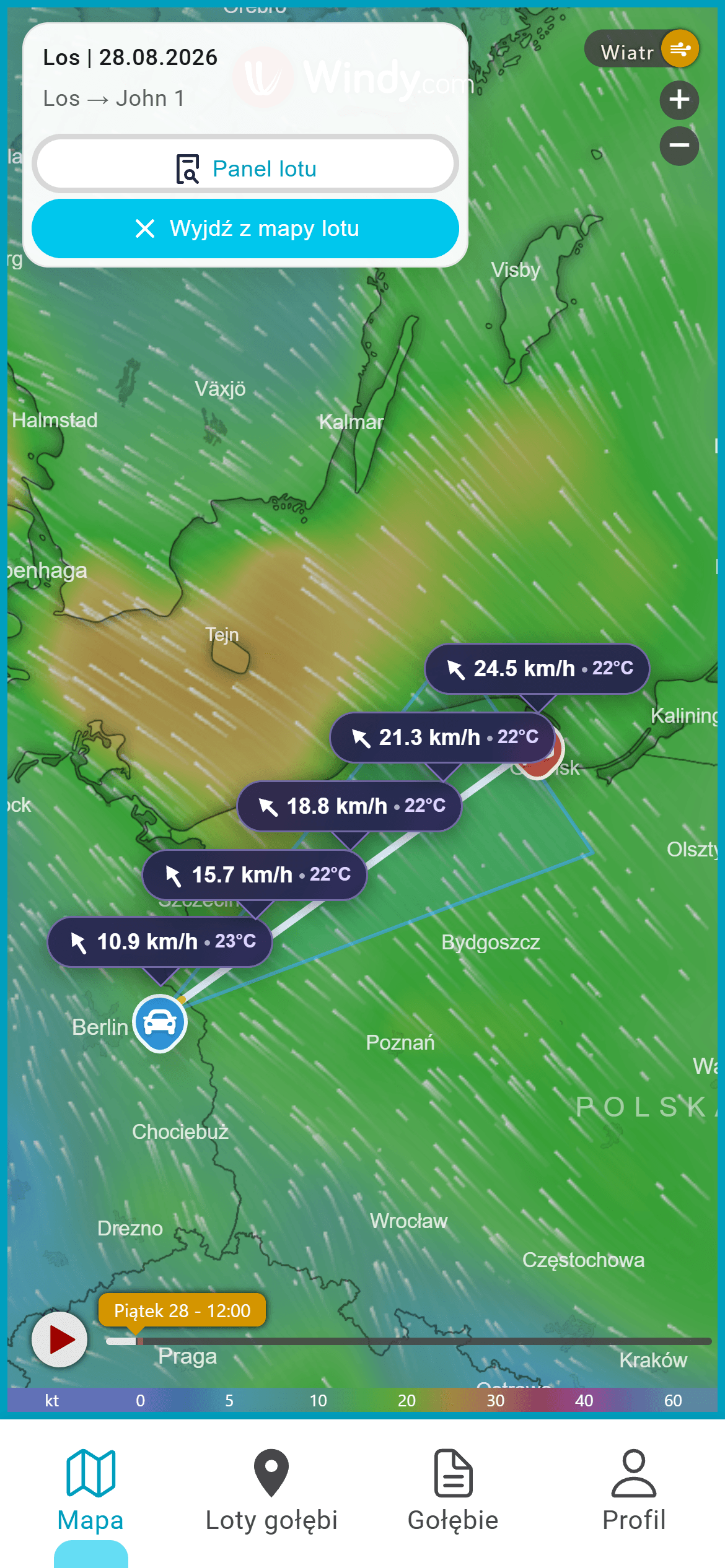
Check wind direction and speed at successive flight points and see how conditions change over time.
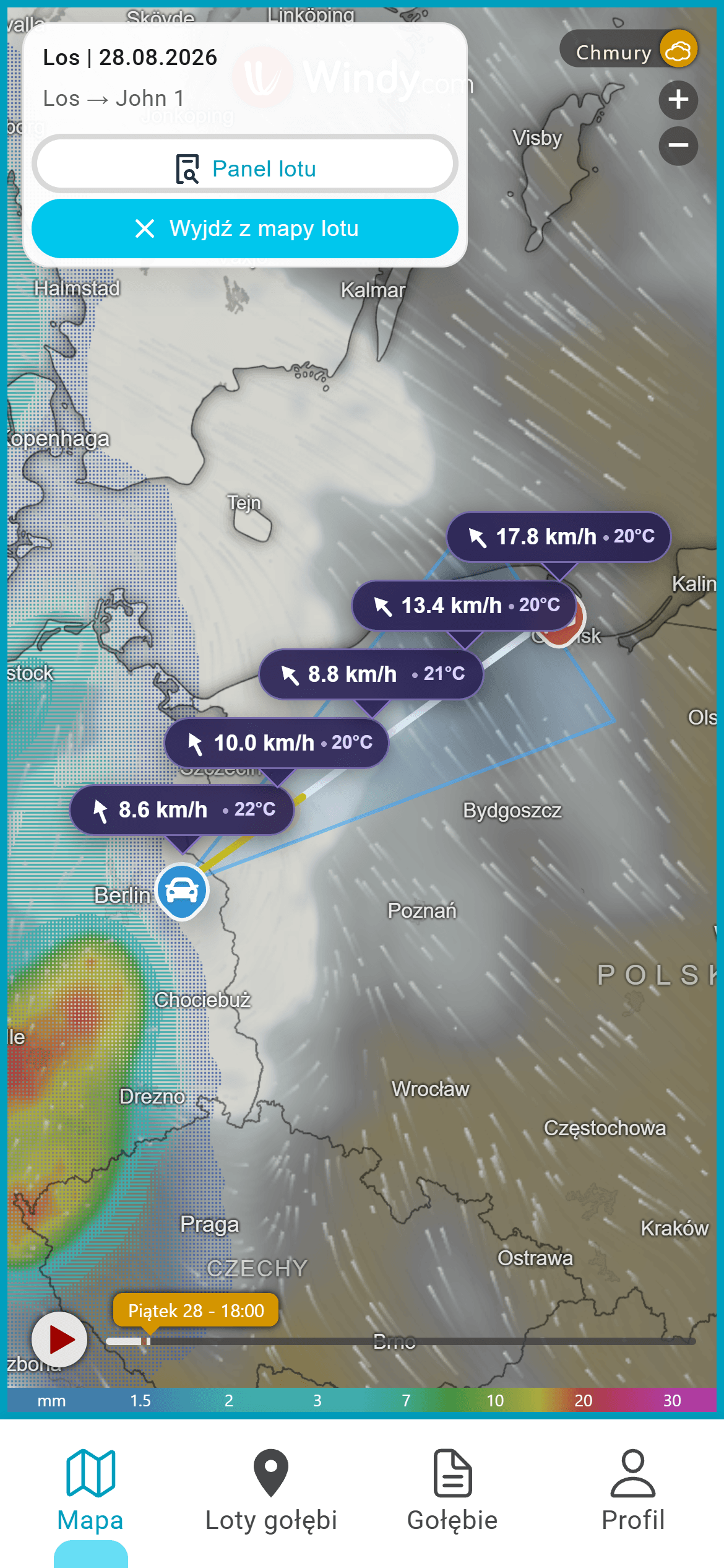
Assess cloud cover and precipitation zones to identify more difficult parts of the route in advance.
Choose the units used for weather and flight analysis in your profile settings. Pigeon Map remembers the choice across maps, summaries and documents.
Change units in DashboardChanging units only changes how values are displayed. It does not change the source weather data or access included in your plan.
There is no need to check routes and forecasts across several websites. Pigeon Map combines the flight map, weather data and key route points in one clear view.
Route, wind, temperature, cloud cover and precipitation are available together, without switching between maps and weather services.
After you select the release point and loft, Pigeon Map draws a direct flight line and intermediate points where you can check conditions.
Compare conditions at successive points, hours and days up to 5 days ahead to choose the date and prepare your pigeons.
Weather maps designed specifically for pigeon breeders
Pigeon Map Weather will place the forecast in the context of a flight, from the release point to the loft. Wind, gusts, visibility, clouds, precipitation and storm risk will make it easier to spot demanding sections and choose a better time.
We are developing an assistant that will help interpret route conditions and highlight important relationships in the forecast.
Create an account and bring the route, forecast and key flight parameters together in one place.
Create account